 |
 |
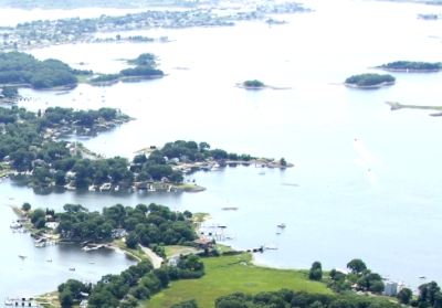
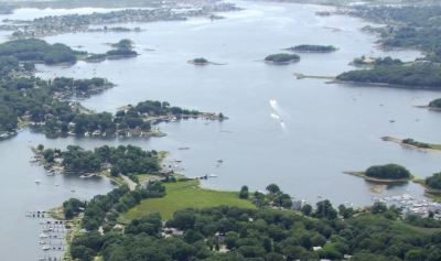
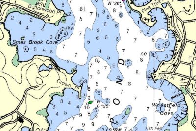
Point Judith Pond
|
|
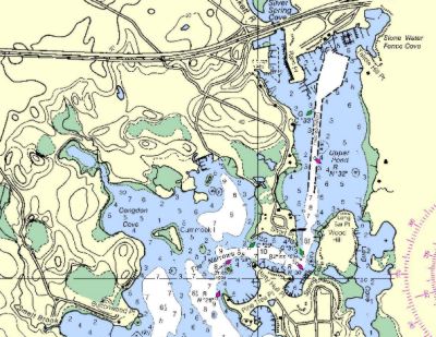
| Point Judith Pond has a number of anchorage
areas. The one we like is Smelt Brook Cove, just west of Buoy 25 (See Chart below). The
anchorage is in the area with 7 foot depths, with a mud bottom that has grass, so it takes
a little care to anchor. If you go East, then south at Buoy 25, there is a large anchorage
that attracts most of the boats. We prefer the Cove. Use NOAA chart 13219. There used to be a very good restaurant in Wakefield, but it changed ownership and became no more than ordinary. Wakefield does offer transportation (taxi and bus) to a supermarket and to Gallilee which has a number of good restaurants. We usually make this a "grill on the boat" stop and just enjoy the peace and quiet of the pond. One caution....the channel up the pond is narrow and sandy. We have not run aground there but others have. An alternative anchoring area is: On going north up the channel pass Turner Pt. go south between Gardner Is. and Beach Is.into the 7' depth area and about where the NOAA 13219 chart has an S-O.This a good holding area although I don't know it's bottom composition .The area about 100 yards south of those Islands is used for Oyster traps,that is why I recommend coming down further south to the area marked S-O. |
 |
 |
 |
 |
 |
 |